rotorua...
The trip back from Whakatane to Rotorua had a distinctly Jurassic-Park-jungle-chase feel to it; pouring rain, whipping wind, mud slides across the roads and a mild feeling of impending doom.
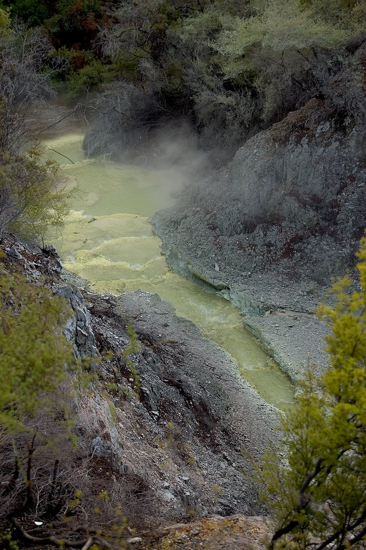
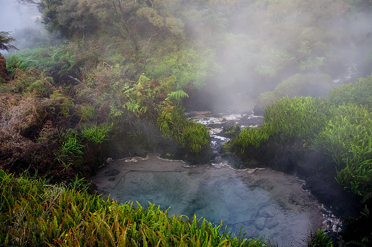
Arriving in Rotorua where the weather wasn't as bad it was only a matter of following the steam to find interesting examples of just how active the planet really is. Anyone I've spoken to who has been to Rotorua has always reduced it to one thing: its smell. While it's true that the place has a strong and inescapable smell of sulphur it's a bit unfair to point to that as its defining characteristic because there are so many more memorable things if you're prepared to look around. Above is a good example - crystal sulphur terraces in a steaming river, the source of which is boiling water spewing right out of the ground. The experience of watching mud bubble and vent steam is another amazing sight...
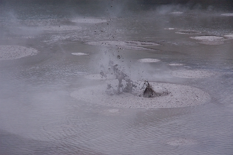
I got too close at one point and was treated to said mud being splattered over my hoodie. Never fear, it and I survived.
Best investment? AquaTech Sport Shield for my camera. It also received a serving of volcanic mud and got a good workout in the constant rain. Without it I wouldn't have been able to take 90% of the photos I took in Rotorua.
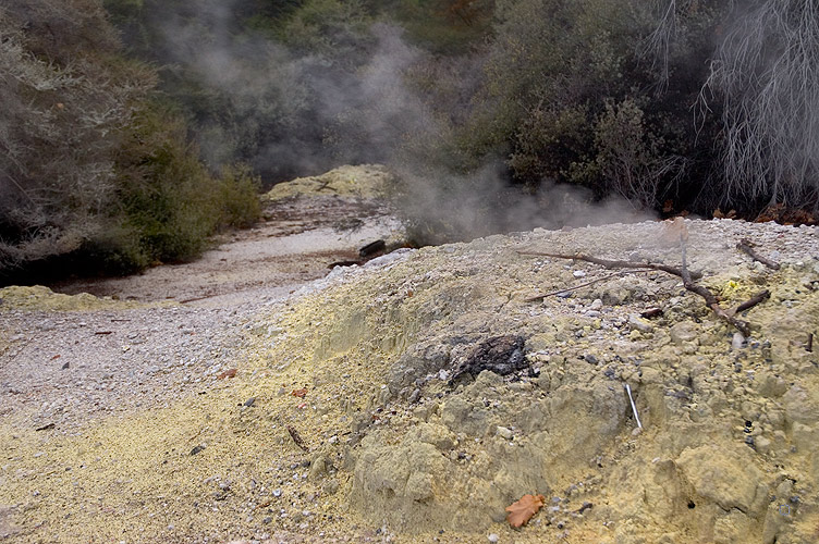
This little fumarole, along with many others like it, was found in the Wai-O-Tapu Thermal Wonderland. Although there's an entry fee it's well worth the price to see things like the giant sink holes and brilliantly coloured chemical lakes. You can walk over the silica terraces and through the clouds of alkaline steam wafting from the Champagne Pool, the edges of which make it resemble a wound in the ground.
As can be seen below, part of the park was closed due to flooding from the night's rain (which in other parts of the country had fallen as massive amounts of snow that blanketed many areas down to sea level).
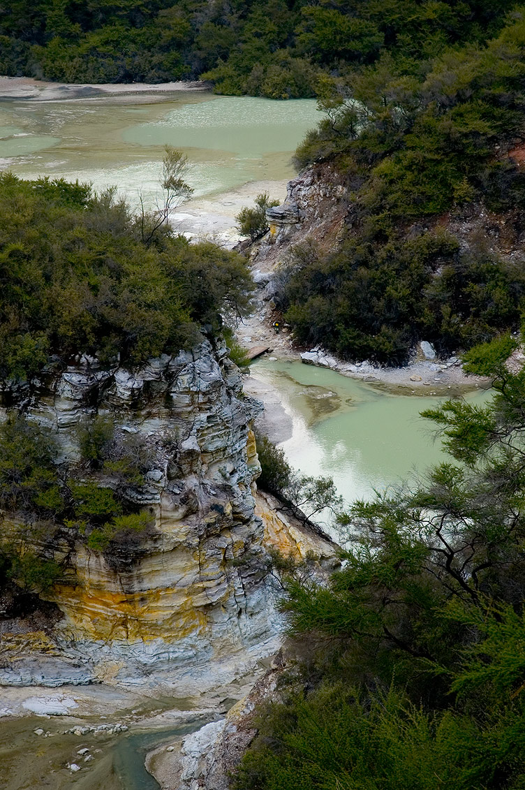
Not far away were the cleaner thermal springs which produce hundreds of litres per minute of clear boiling water. It's even possible to bathe in controlled areas fed from here, but I was content just to watch the water rising up from deep inside the earth.
Although I woke up the next morning to a brief "there's that smell again" moment, the sights of Rotorua are what really stick in my mind.
as changeable as the...
Back through Ohakune and east, with grassy fields stretching out everywhere. If you look really closely above you can see a few white specks - yes, more sheep (there really are a lot of sheep!).
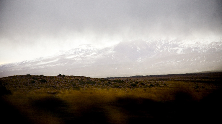
Then north along the Desert Highway where the weather started closing in. Above is Ruapehu again, and below is about a half an hour later. It's amazing how the landscape and the sky can change in such a short period of time...
Back around Taupo and a quick stop in the town of the same name (which is on its north east shore), then on through Rotorua. Being a thermally active area the smell of sulphur was ever-present and occasionally on the side of the road steam could be seen rolling up from the ground. Then, night time now, east to Whakatane on the edge of the Bay of Plenty. The road was twisty, as most roads in that area seem to be, wriggling through mountains and next to the shores of numerous lakes before reaching the plains and finally Whakatane.
Whakatane was to be the base for the night, with the plan to head to White Island, an active marine volcano 50 km off the coast, by boat the following day. As the new day dawned it was obvious that wasn't going to happen, with almost horizontal pounding rain obscuring everything. It was a shame, but you can't change the weather! At this point I decided to try to get a local GPRS internet plan from Vodafone NZ, but after going through a huge sign up process that involved a copy of my passport, they couldn't create the account because of my lack of a New Zealand residential address. So after a brief look around Whakatane it was time to head inland again to Rotorua to check out things by the light of day.
level 1...
After arriving in Napier it was time to pick up the rental car and start exploring the North Island. Napier is well known for its Art Deco buildings, the result of a rebuilding effort after an earthquake and fires in 1931 destroyed much of the town. With its long tree-lined boulevard, Marine Parade, following the sweeping bay and providing views across to the slanted cliffs of Cape Kidnappers, building façades tightly huddled together at the edges of the city streets and architectural surprises like the Veronica Sunbay, it's like the Mediterranean with a film noir influence.
From Napier the plan was to travel North... by North-West.
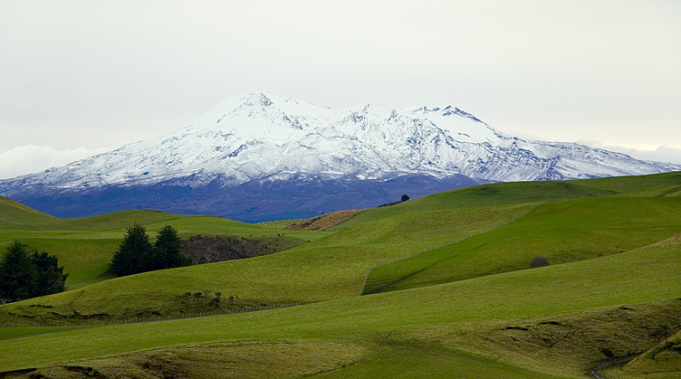
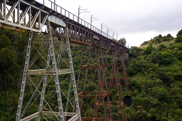
Past a lot of sheep and the Ahimanawa Range we arrived at Lake Taupo, a massive caldera almost the size of Singapore; it was windy and the lake had an oil painting-like choppiness of emerald and dark blue breaking on the gravel beach. On around the east of the lake, which seemed as though it would go on forever, then south to the end of the Taupo Volcanic Zone. Mount Tongariro and recently-active Ngauruhoe rose up to an increasingly stormy sky as we travelled west and then south, snaking around the walls of steep valleys like the bridge-spanned example above, on to the plains and east around Mount Ruapehu to the town of Ohakune.
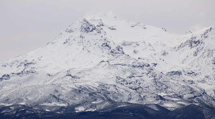
Mount Ruapehu is an active volcano, the tallest mountain on the North Island and home to several ski fields such as Turoa, not far from Ohakune. After having lunch in Ohakune and calling to check on the weather conditions for a trip to White Island the following day (which was looking increasingly unlikely due to forecast gales), we took a trip up to Turoa to get a closer look at the snow on Ruapehu. The landscape changes dramatically in the space of only a few minutes, from open plains through a dense rainforest and up to a cold waste land of volcanic rock and tussock. In the distance...
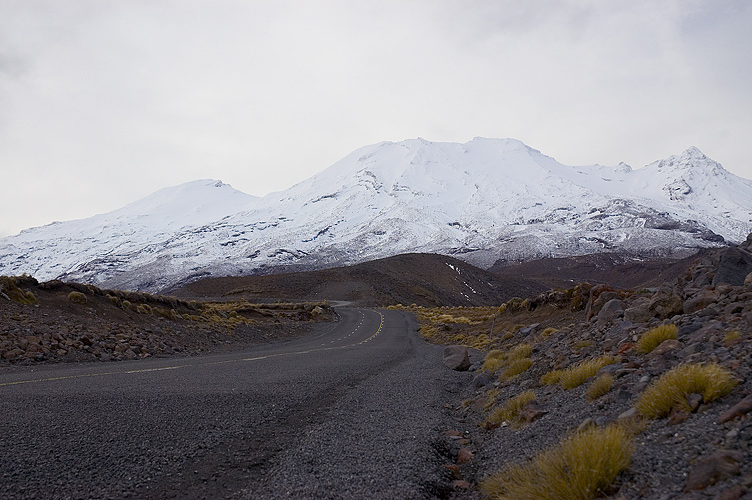
... the mammoth peak of Ruapehu.